About Bloor Homes
Bloor Homes is a family-owned private housebuilder with a reputation for quality, consistently achieving the highest five-star rating for customer satisfaction in the annual National Housebuilders Federation National New Homes Customer Satisfaction Survey. Over 97% of our customers would recommend us to family and friends.
Find out more at: https://bloorhomes.com/
The site
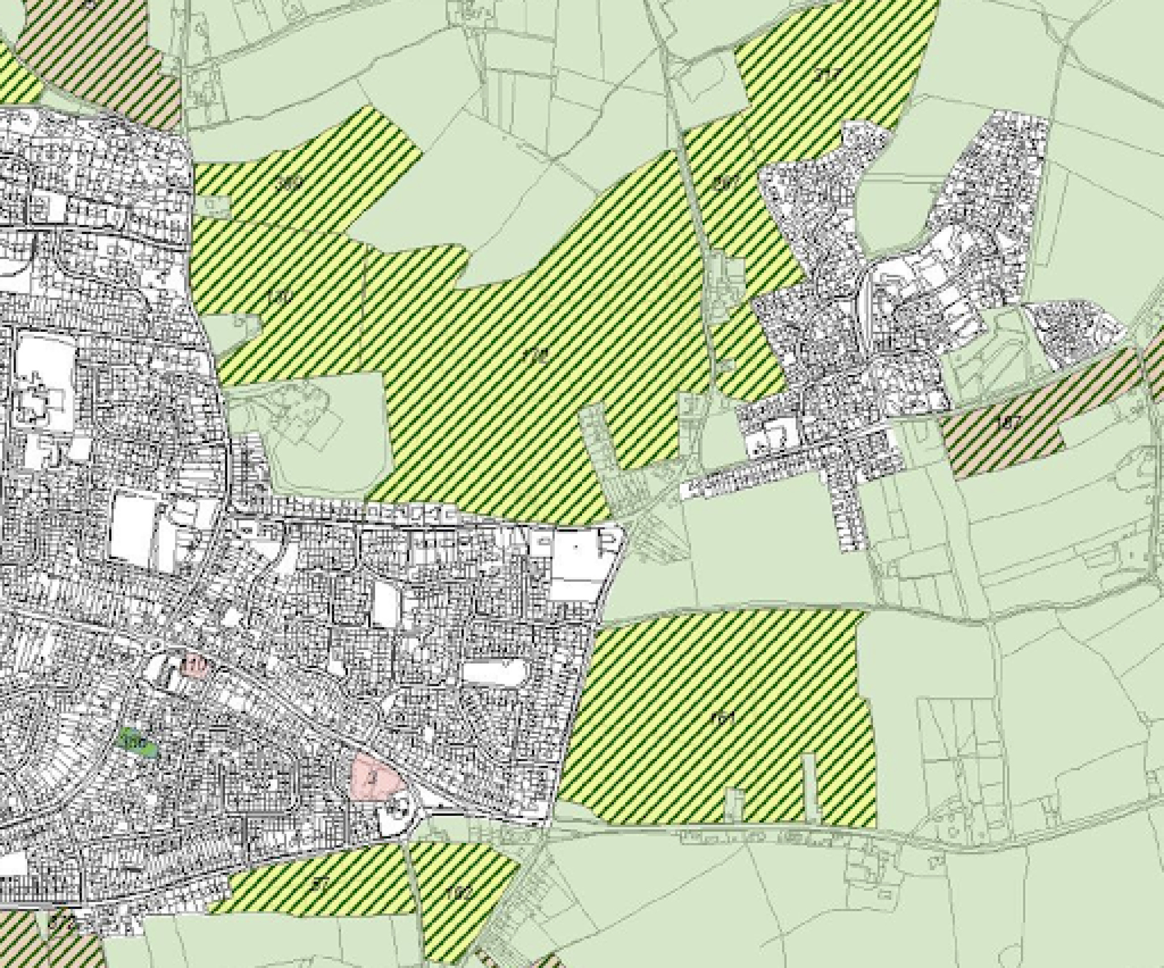
The 27.31ha site consists of two parcels either side of Coulter Lane – a larger parcel to the west and a smaller one to the east side of the lane. The site occupies an infill location between the St. Matthew’s development to the east and Fulfen Primary School to the west, with the urban areas of Burntwood beyond. The main urban area of Burntwood lies to the south and west, including a number of existing properties on Church Road and Upfields.
The site slopes from its south-eastern corner to the north-west towards the stream corridor that passes along its north-western extent.
Existing mature trees and hedgerows to be retained as much as possible and enhanced with additional landscape planting, with development parcels shaped by existing field patterns. The site is currently predominantly in arable agricultural use, alongside areas of modified grassland, both of which are of relatively low biodiversity value.
There are currently no public rights of way providing public access to the site.
No development is proposed in the eastern parcel of the site in the outline planning application.
Site location plan (no development is proposed in the site parcel east of Coulter Lane) - click to enlarge
Planning policy context
Increased housing targets for Lichfield District
The site has been promoted through Lichfield District Council's emerging Local Plan since 2015. As a result of that process, part of the site was previously safeguarded to meet future housing need in the emerging Local Plan. However, that plan was withdrawn from examination in October 2023, with Lichfield District Council restarting the preparation of a new Local Plan.
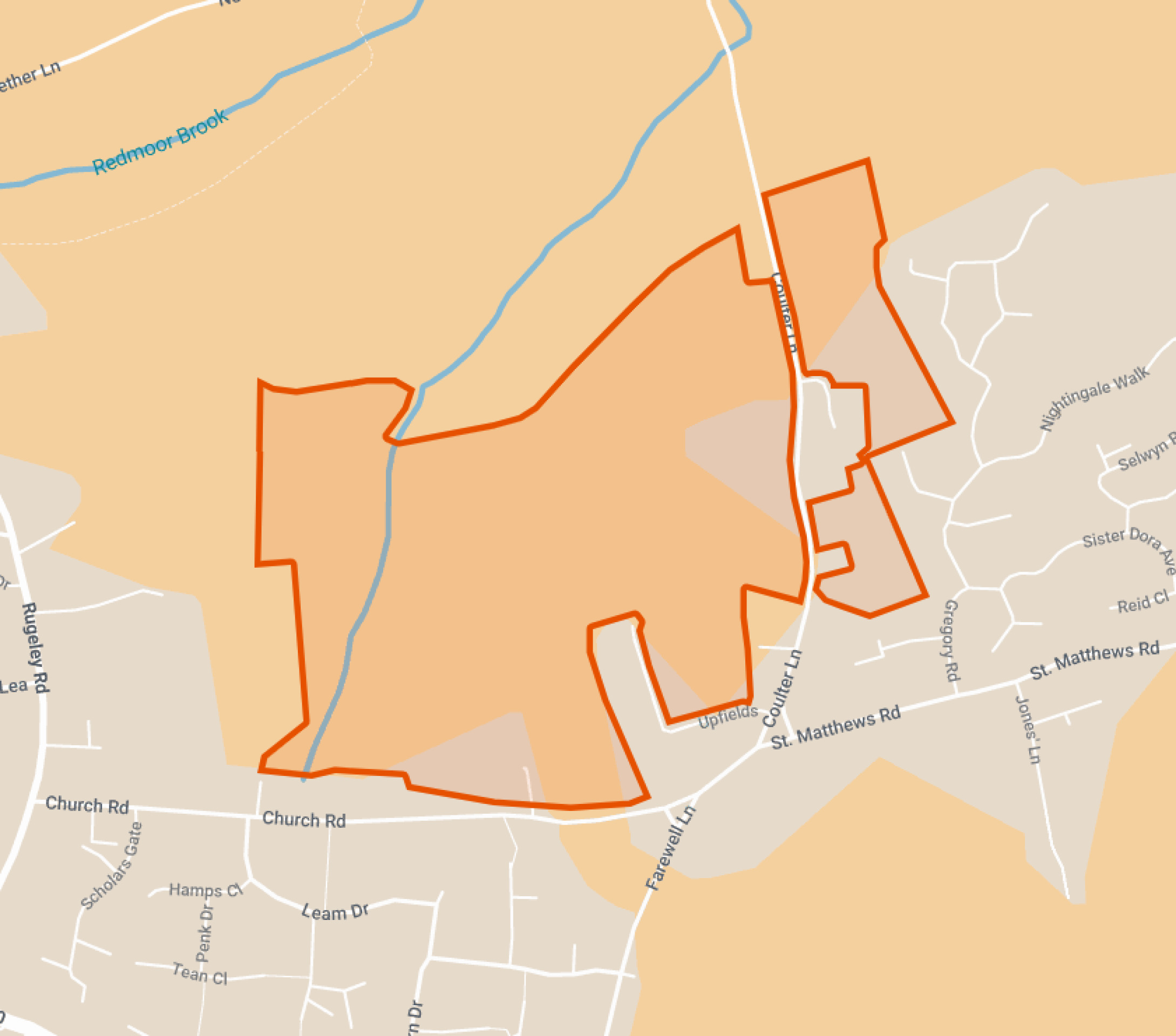
Lichfield District Council SHLAA assesses the site as “Suitable”, “Available” and “Achievable”.
Since the Local Plan process was restarted, the government introduced a new Nation Planning Policy Framework (NPPF) in December 2024. This has increased the number of homes that need to be delivered in Lichfield District from 289 to 753 new homes per annum, an increase of 260%.
An extract from Lichfield District Council Strategic Housing Land Availability Assessment which assesses the site (172 and 267) as being “developable” - click to enlarge
Grey belt
A new grey belt policy was also introduced in the NPPF. This allows development in some areas of green belt, provided certain criteria are met. Grey belt includes land that ‘does not strongly contribute’ to green belt purposes which are set out in the NPPF. The site at Church Road is surrounded by existing development to the west, east and south. It therefore meets the criteria for grey belt land and is being brought forward for a sensitive, landscape-led sustainable infill residential development on this basis.
Five-year housing land supply
The new NPPF also requires that Lichfield District Council is able to demonstrate a five-year housing land supply. This is the amount of land that the Council must identify to ensure there are sufficient deliverable sites for residential development over the next five years. Lichfield District Council currently can only demonstrate an approximately 3.65 year supply of deliverable housing land. In light of this, an outline planning application for grey belt land at Church Road is now being brought forward to contribute to meeting this housing delivery shortfall, rounding off the settlement edge at a sustainable, infill location.
An outline planning application establishes the broad principles of development, such as access arrangements, illustrative concept layout, number of homes and general extent of development.
If outline planning consent is granted, a detailed planning application called a Reserved Matters planning application would be prepared. This would include more detail such as architecture, materials, detailed layout and landscaping, and would be subject to further consultation with the local community before being submitted for determination. Both outline and Reserved Matters planning applications are subject to Statutory Consultation carried out by the Local Planning Authority (Lichfield District Council).
Site constraints and opportunities
How local feature and landscape have shaped the proposed illustrative layout of the new neighbourhood.
In preparing the concept layout for the site, the technical team appointed by Bloor Homes first of all considered the landscape, drainage features, topography and local context of the site. The following plan shows some of the features and constraints that have informed the emerging outline proposals. Key features include areas of surface water flood risk, existing field patterns, existing gas mains and sewers.
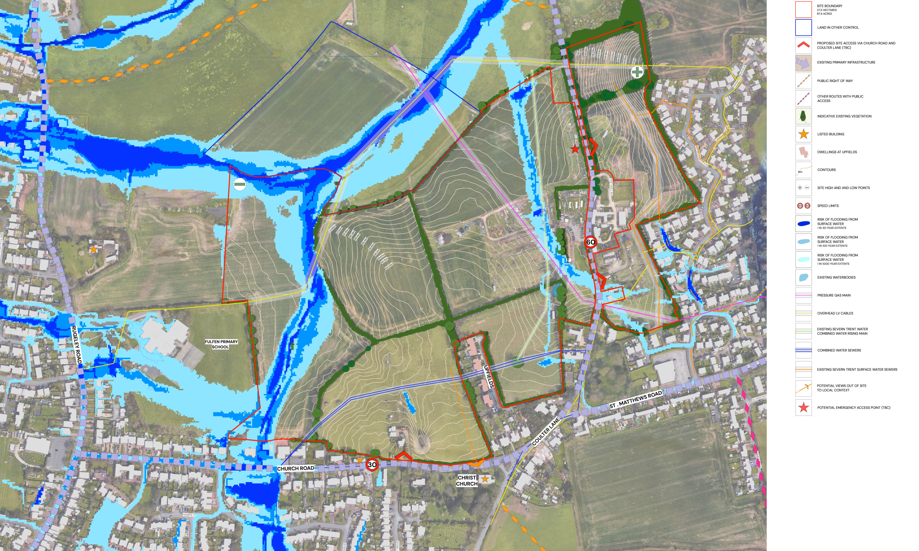
This plan shows analysis of some of the site features that have influenced the illustrative masterplan for the new neighbourhood - click to enlarge
The outline proposals for new homes and extensive landscaped public open spaces
Following extensive consultation, family-owned, five-star housebuilder, Bloor Homes, has submitted outline proposals for a residential neighbourhood at a sustainable infill location at Church Road, Burntwood.
The submitted plans have incorporated a number of significant changes following pre-application public consultation and ongoing technical work, and would provide:
- Up to 250 high-quality family and affordable homes, with a mix of house types and sizes proposed, including the potential to provide bungalows.
- Affordable housing potentially local policy (28%) plus additional 15% in line with grey belt policy – ie. up to 43% affordable housing.
- Development significantly scaled back from that proposed during consultation, with key changes including:
- Parcel at Coulter Lane removed from the proposals. No development east of Coulter Lane.
- Number of homes reduced by at least 50, from the up to 300 proposed during consultation to up to 250 in the outline planning application.
- Development removed from the land east of Upfields.
- Community hub proposed for the Church Road frontage removed in response to community feedback.
- Additional landscape planting to protect the setting of listed cottage on Church Road.
- More than two-thirds of the site retained as open space, including:
- Extensive new landscaped public open spaces
- Green corridors
- Biodiversity areas
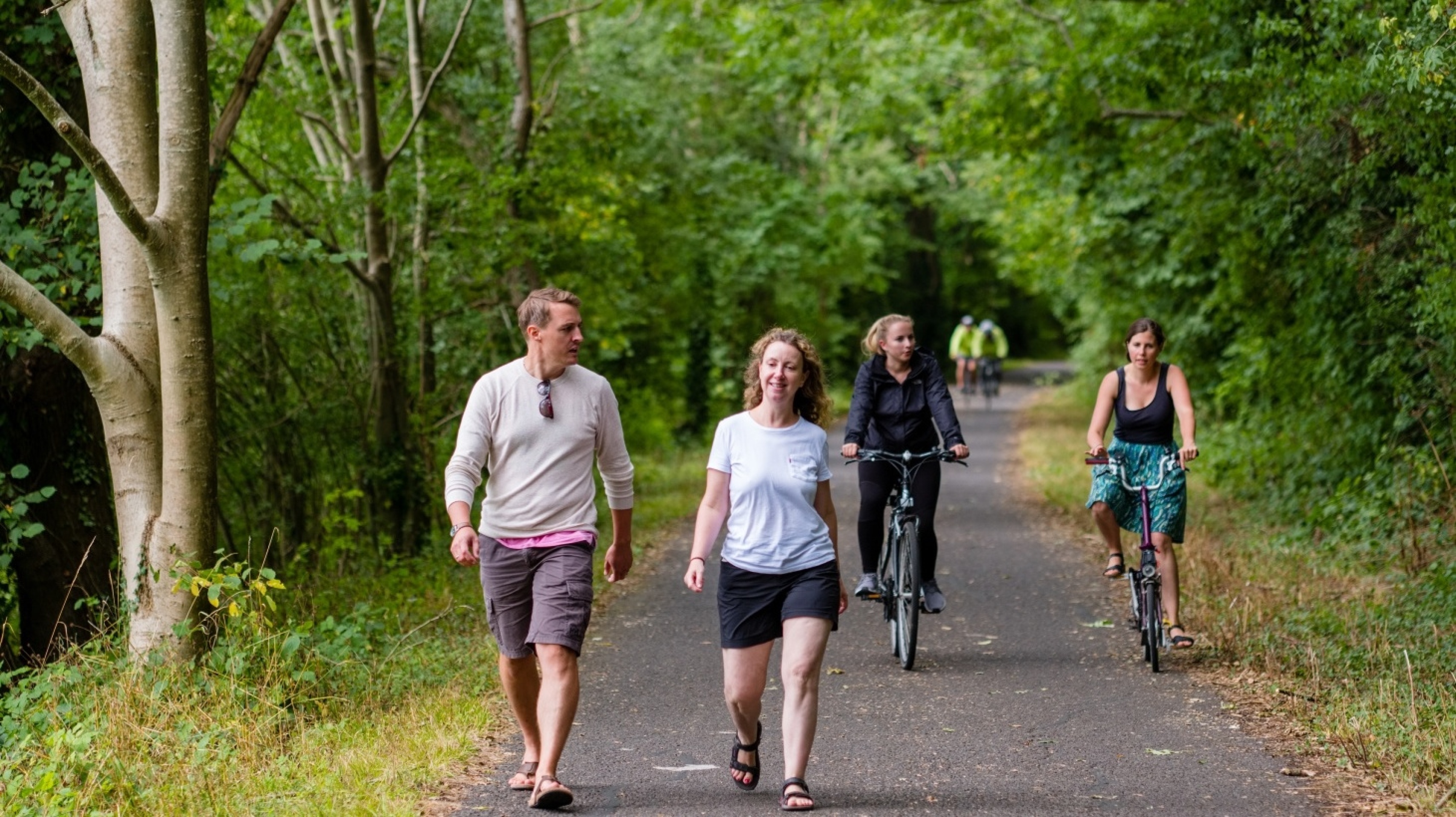
- A network of public walking and cycling routes
- Play areas
- Allotments
- Sustainable drainage system providing wetland habitats
- The retention of existing mature trees and majority of hedgerows, with additional planting, to significantly increase tree cover across the site.
- Significant financial contributions to invest in local infrastructure such as healthcare, education etc.
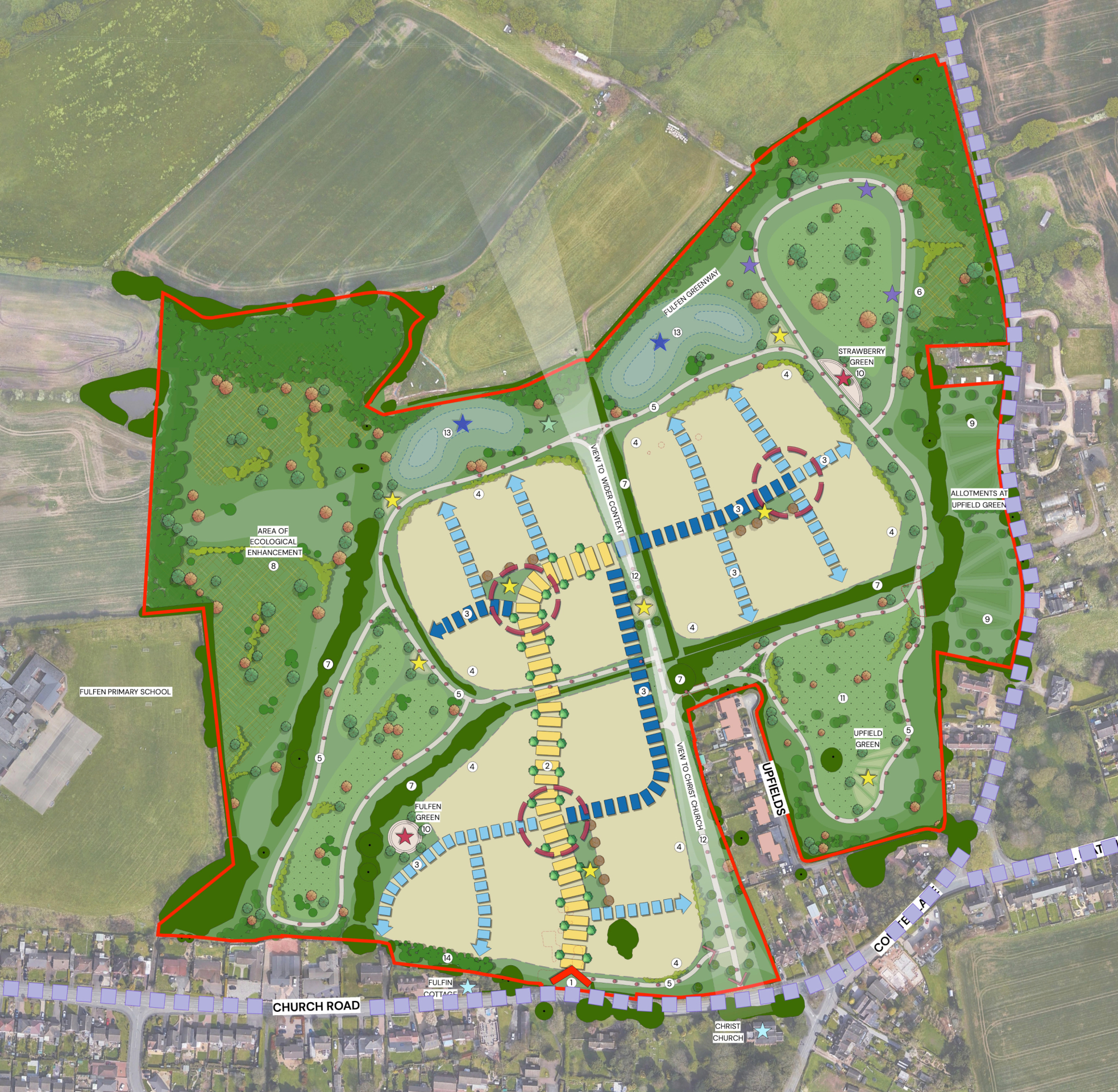
Illustrative outline layout of the proposed new neighbourhood – click to open view the proposals on our interactive map
Homes and community facilities
House types
The planning application is an outline planning application. This type of planning application sets out the broad principles of development, such as maximum number of homes, an illustrative layout and site access arrangements. Should outline planning permission be received, finer details such as specific house types, detailed layout, architecture etc would be subject to a subsequent further planning application (called a Reserved Matters planning application). This would involve further consultation with the community.
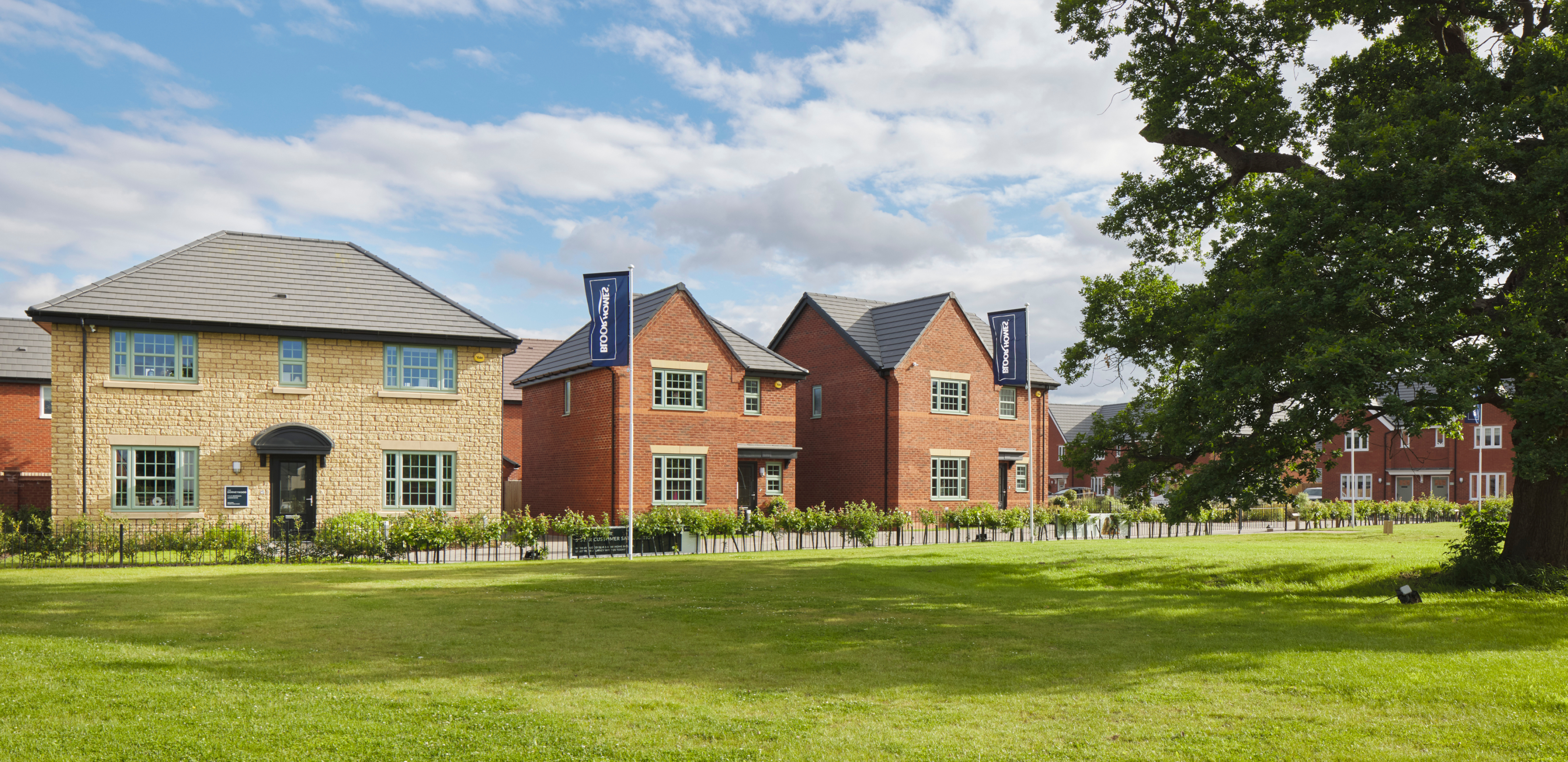
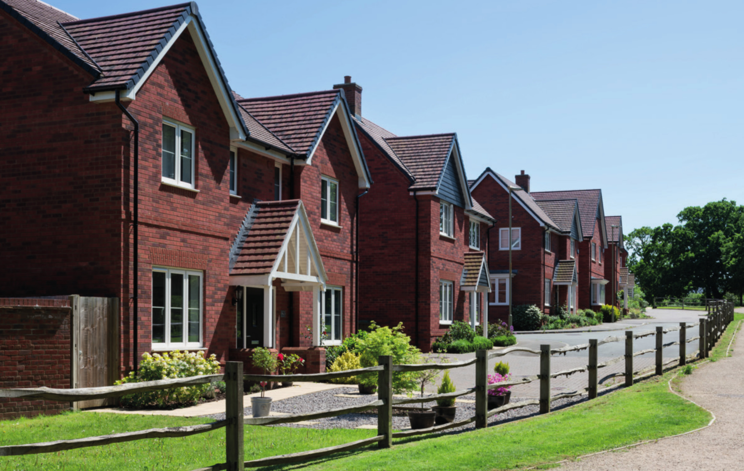
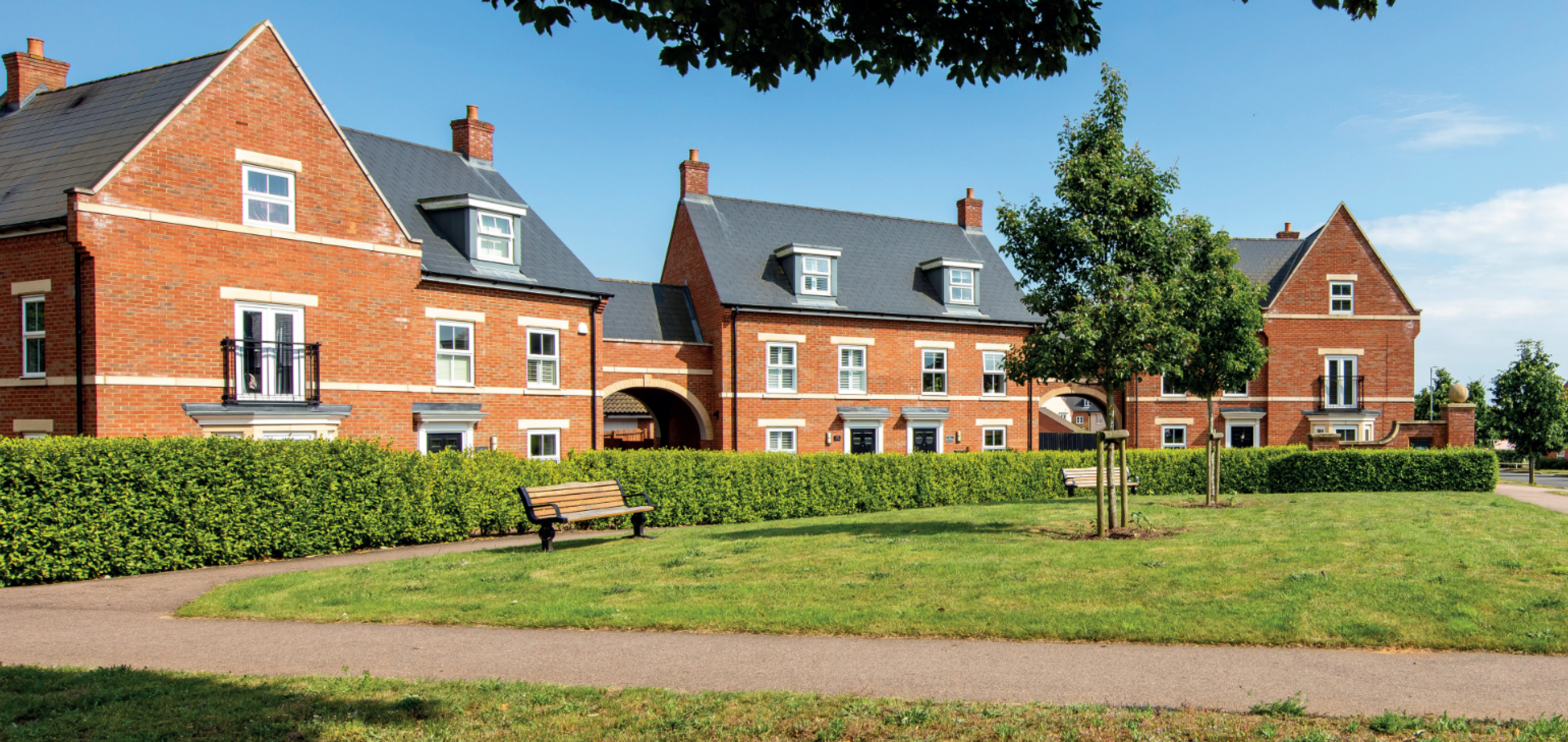
While house types would be determined at the Reserved Matters planning stage, we have provided imagery of existing Bloor Homes developments on this website to provide an idea of the types of high-quality homes we build.
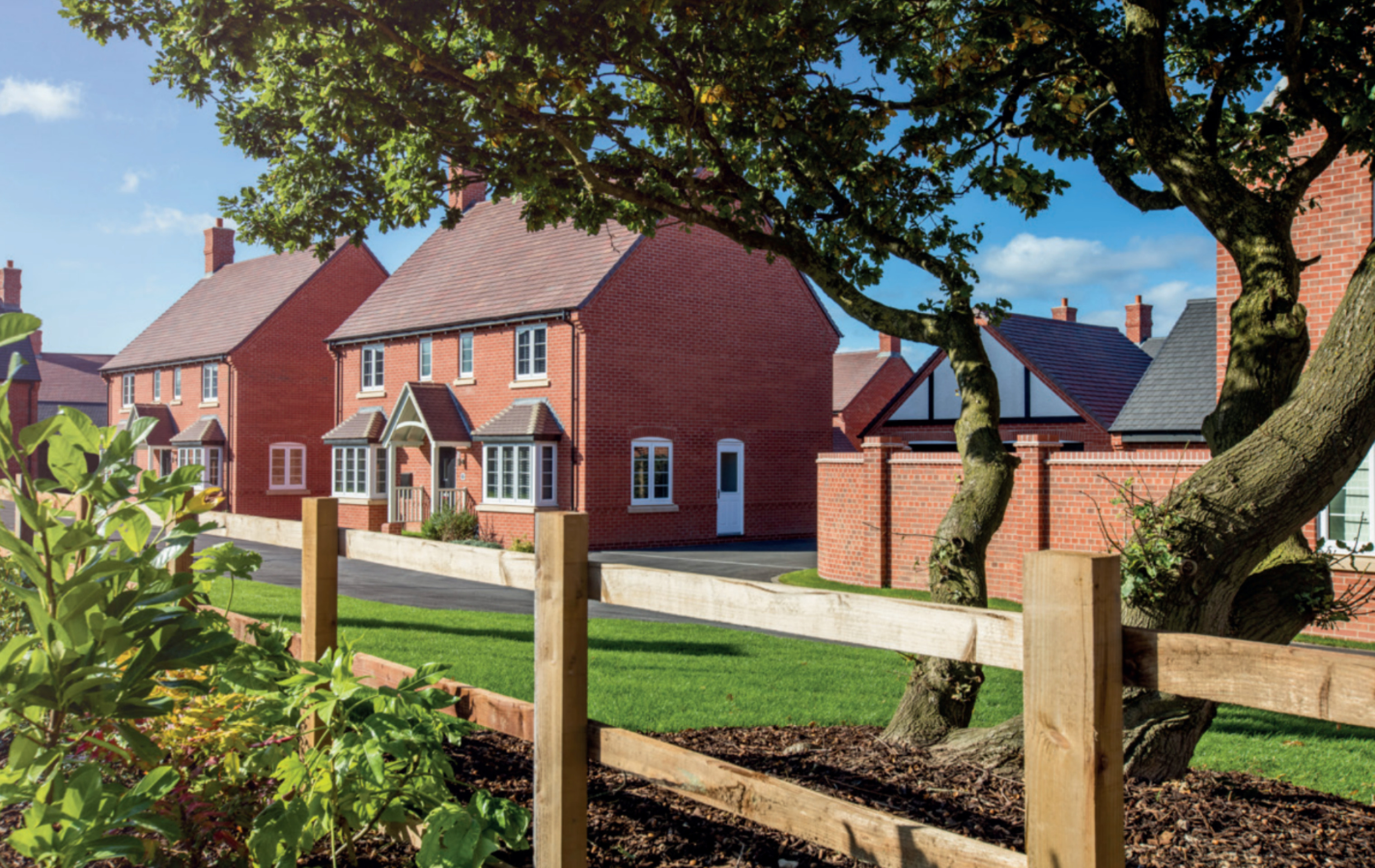
Examples of some recent Bloor Homes developments. Click to open a gallery of images.
Affordable homes
As the site is being proposed for development as a grey belt site, up to 43% of the new homes would be classified as affordable homes in line with national policy (28% requirement from local policy, plus 15% uplift in line with grey belt policy). This will provide opportunities for those on lower incomes with connections to the local area to secure a home of their own. Affordable housing is anticipated to be provided in a mix of affordable rent and shared ownership homes, however this will be determined in consultation with Lichfield District Council’s Housing Team.
We are happy to work with Lichfield District Council for Local Occupancy Criteria to be applied to the affordable housing provision, ensuring that it is prioritised for people with local connections if this is a priority in community feedback.
Sustainable homes
We want to deliver homes that are sustainable now and contribute to a cleaner, greener future.
We know that sustainability is hugely important to communities across the country. The new homes for Burntwood will be built to be energy efficient.
It is anticipated that the neighbourhood could be gas-free, with homes provided with measures such as air source heat pumps, solar panels and the use of the latest materials and techniques to maximise insulation, air tightness and heat recovery, will create an uplift in energy efficiency of 75-80%.
The new homes will incorporate sanitaryware and appliances that meet the highest water efficiency standards.
Electric vehicle (EV) charging points will be provided for all homes with on plot parking, together with access to communal EV charging points for the whole neighbourhood.
To minimise the impact of construction, we always aim to procure materials from sustainable sources and recycle construction waste as far as is possible.

The new homes for Burntwood will be energy efficient and include measures such as EV charging
Community hub
The proposed new neighbourhood had included the provision of a community hub fronting Church Road during consultation. However, this has been removed in the outline planning application in response to community feedback.
Investing in wider community infrastructure
A key consideration with a planning proposal such as this is to ensure that local services receive the investment they need to accommodate housing growth in the local area. The development will generate investment into local infrastructure such as healthcare and education, and this will be informed by consultation carried out by Lichfield District Council with statutory bodies such as the local NHS Integrated Care Board and the local education authority and will be secured via legal agreement between Bloor Homes and the Council.

The development will generate significant funding for key infrastructure such as healthcare and education, to be determined in consultation with bodies such as the NHS, local education authority, etc
Access and highways
Vehicular access will be taken via a new junction with Church Road.
A Transport Assessment forms part of the outline planning application. This assesses the impact of the development proposals on the local and wider highway network. Bloor Homes is engaging with the Local Highways Authority to help inform the development proposals and any local highways improvements that will be delivered as part of the scheme.
The Transport Assessment considers local transport issues and identifies the likely impacts of the proposed development, with all modes of travel considered. It outlines the methodology for assessing the baseline conditions and proposed development schedule and provides a summary of the various associated transport implications including any mitigations and local highways improvements that would be delivered by the proposed development.
A Framework Travel Plan has also been submitted alongside the application. This will set out measures to promote the use of sustainable modes of transport to and from the site. The Framework Travel Plan and Transport Assessment will both be prepared in accordance with the Ministry of Housing, Communities and Local Government’s Planning Practice Guidance in relation to Travel Plans, Transport Assessment and Statements (2014).
A full review of the existing conditions of the site has been undertaken including a review of the local highway network, public transport services, walking and cycling infrastructure and local facilities (food and non-food retail, health, leisure, employment, education, etc). Pedestrian and cycle desire lines have also been reviewed in relation to accessing these local facilities and amenities. A review of Public Rights of Way routes in the area immediately surrounding the site has also been completed.
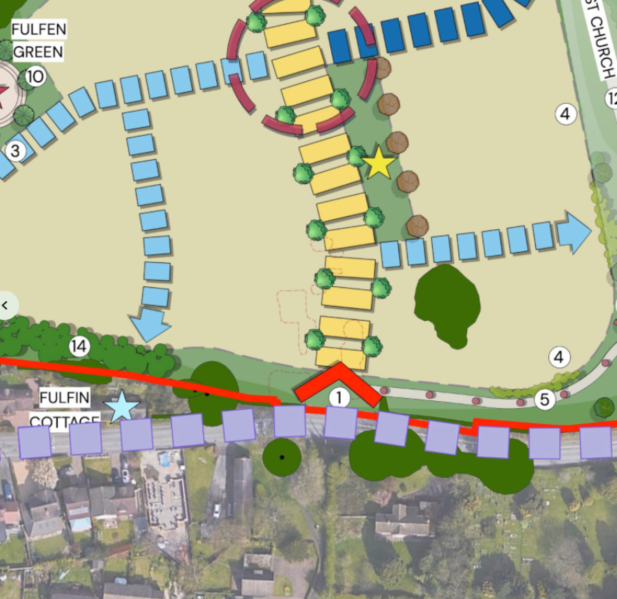
An indicative masterplan extract showing the proposed access from Church Road - click to enlarge
Green infrastructure
We want to ensure that natural habitats are protected while we deliver new homes for people and families.
We are conscious of the ever-increasing importance of ensuring that development is sustainable, protecting and enhancing natural habitats and green infrastructure as much as possible whilst delivering much needed homes for people and families.
The provision of high-quality green public open spaces is at the heart of the landscape-led approach to sensitive development at Church Road. Nearly two-thirds of the overall development site will be retained as open space, including play areas, landscaped public open space, informal play and habitat areas. Existing mature trees and the majority of hedgerows will be retained, with development parcels shaped by existing field patterns. Extensive additional planting will deliver a significant increase in tree cover across the site.

Ecology
The site has been subject to a baseline ecology habitat survey, including a desk study and Habitat Condition Assessment survey, with more detailed (Phase 2) surveys being undertaken relating to breeding birds, bats, badgers, great crested newts, reptiles, otter and water vole.
A variety of ecologically valuable habitats across the site include a stream, mixed scrub, two ponds, a network of hedgerows, broad-leaved woodland and mature trees. However, the majority of the site is currently intensively managed agricultural land of low ecological value and as such there are opportunities to deliver development within this landscape whilst retaining more valuable habitats. Furthermore, the landscape-led approach to development has the potential to provide a 10% net gain in biodiversity, as well as providing enhanced ecological connectivity through the development of wildlife corridors, establishing a coherent green network.
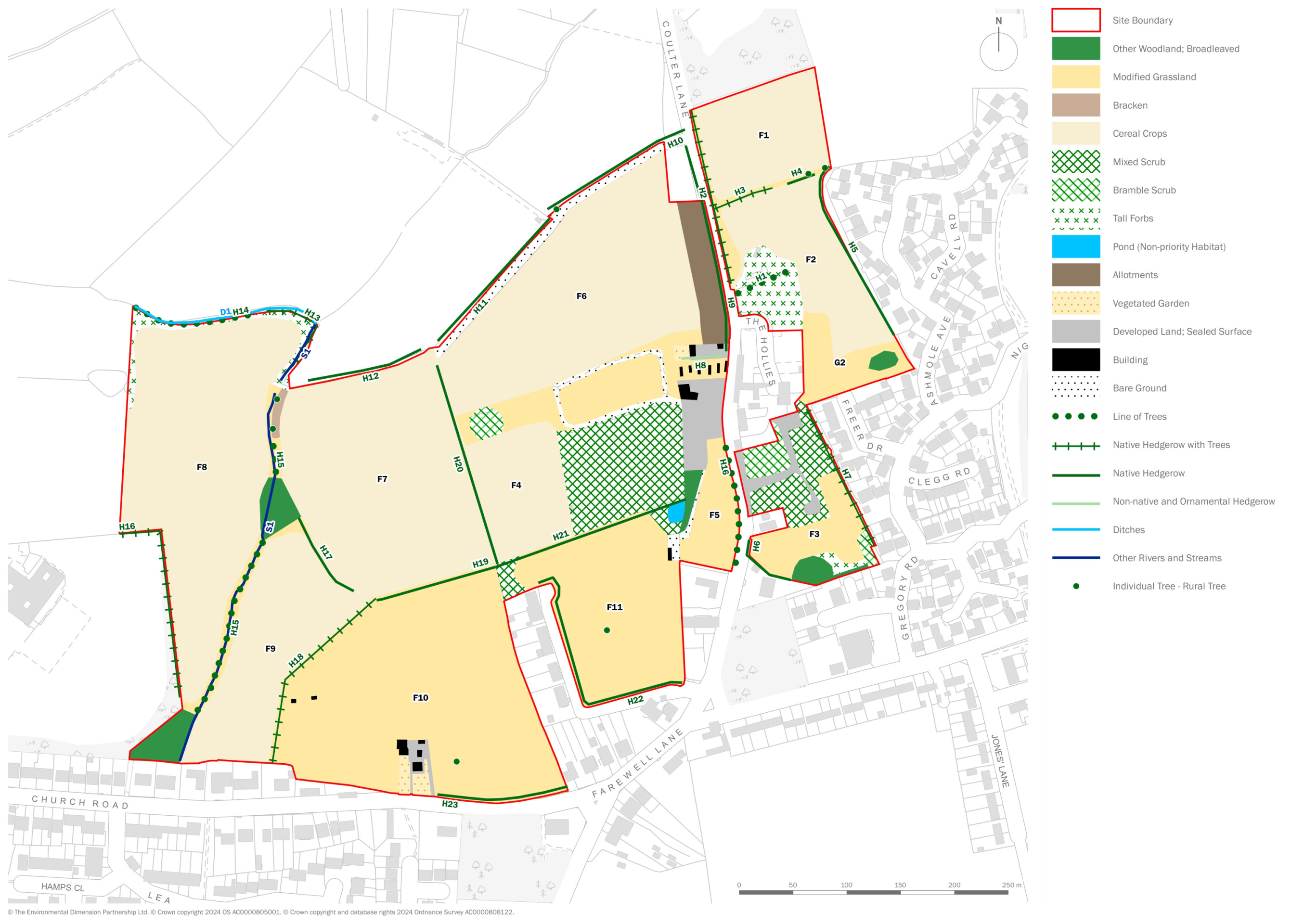
A habitat analysis plan showing the current habitat areas within the wider pre-application consultation site - click to enlarge
Homes for Nature
Bloor Homes is proud to be a member of the Homes for Nature programme. This will see the installation of nesting bricks/boxes in every new home and hedgehog highways between gardens.
Drainage
Flood risk
The Environment Agency’s Flood Map for Planning confirms that the area within the site to be developed is located within Flood Zone 1 and therefore has the lowest probability of flooding (less than a 0.1% annual chance). There are areas of the site within Flood Zones 2 and 3 (medium to high flood risk) along the route of the existing watercourse which flows south-to-north through the eastern area of the site. This area will be kept clear of development.
Foul Drainage
Foul water flows from the development are to be conveyed via a new foul pumping station and rising main to the existing public sewer network, subject to agreement with Severn Trent Water.
Surface Water Drainage
A new surface water drainage system will be implemented to serve the site. This will consist of a new piped network to convey flows to a series of detention basins located within the lower areas of the site. The detention basins will provide storage to allow surface water flows to be discharged from the site at greenfield runoff rates to the existing watercourse network, therefore not increasing flood risk within the site, or off-site. The detention basins will be sized to accommodate flows up to and including the 1 in 100 year storm events, plus 40% climate change allowance. In addition to their role in managing surface water drainage, the detention basins will also provide new wetland habitat areas, contributing to biodiversity on the site.
As well as the provision of new detention basins, the new drainage network will include the provision of additional sustainable drainage systems (SuDS) which may take the form of swales, filter drains, filter strips and permeable paving.
The sustainable drainage system for the new neighbourhood will also provide biodiversity benefits through the provision of wetland habitat.
Heritage
The illustrative masterplan has been informed and guided by a preliminary heritage assessment. This has assessed potential impacts on those heritage assets located in the vicinity and has informed design development.
Listed buildings located in the immediate vicinity of the site include:
- the Grade II listed Fulfen Farm (NHLE 1188086), located on Rugeley Road to the west;
- the Grade II listed no. 57 Church Road (NHLE 1188068), located to the south; and
- the Grade II listed Christ Church (NHLE 1038877), also located to the south.
The illustrative masterplan has provided public open space that maintains visual connections with those heritage assets closest to the site. This includes the provision of an area of open space to the north of the Grade II listed Christ Church that enables unimpeded longer views of the church from within the site (looking south).
An area of ecological enhancement provides a substantial buffer to the Grade II listed Fulfens west of the redline boundary.
The settings of those non-designated heritage assets located in the immediate vicinity of thesubject site will not be impacted by the proposed development.
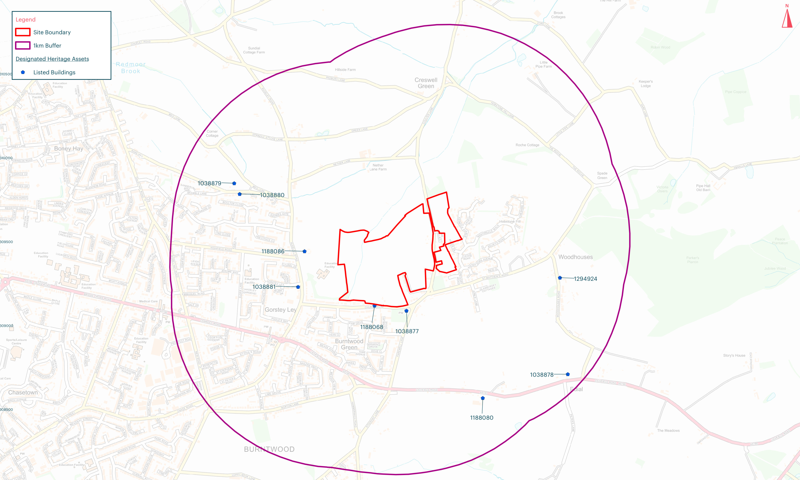
Listed building locations - click to enlarge
Archaeology
Baseline data suggests that the site is unlikely to contain archaeological interest. A desk-based assessment, supplemented by geophysical survey, will be carried out as part of the outline planning application.
Construction Management Plan
To ensure that the impact of construction is kept to a minimum, a Construction Management Plan is being prepared and will form part of the planning conditions of any outline planning permission.
Other technical considerations
In preparing an outline planning application for the proposed development, a full suite of technical studies is being completed, including Highways, Flooding and Drainage, Ecology, Utilities, Noise, Heritage, Contamination etc. It is not anticipated that there will be any significant technical constraints to delivering a high quality, sustainable new neighbourhood at this site.